


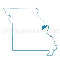
225-Augusta Voting District, St. Charles County, Missouri
About
Outline

Summary
| Unique Area Identifier | 609632 |
| Name | 225-Augusta Voting District |
| County | St. Charles County |
| State | Missouri |
| Area (square miles) | 55.04 |
| Land Area (square miles) | 52.38 |
| Water Area (square miles) | 2.66 |
| % of Land Area | 95.17 |
| % of Water Area | 4.83 |
| Latitude of the Internal Point | 38.60618170 |
| Longtitude of the Internal Point | -90.85825750 |
Maps


Graphs
Select a template below for downloading or customizing gragh for 225-Augusta Voting District, St. Charles County, Missouri


Neighbors
Neighoring Voting District (by Name) Neighboring Voting District on the Map
- 221-Weldon Spring Voting District, St. Charles County, MO
- 229-Callaway Voting District, St. Charles County, MO
- Dutzow Voting District, Warren County, MO
- LABADIE Voting District, Franklin County, MO
- SOUTH POINT Voting District, Franklin County, MO
- ST ALBANS Voting District, Franklin County, MO
- WASHINGTON WARD 1, Franklin County, MO
Top 10 Neighboring County Subdivision (by Population) Neighboring County Subdivision on the Map
- Boone township, St. Charles County, MO (41,639)
- Boles township, Franklin County, MO (18,108)
- Washington township, Franklin County, MO (13,982)
- Charrette township, Warren County, MO (5,579)
- St. Johns township, Franklin County, MO (5,078)
Top 10 Neighboring Place (by Population) Neighboring Place on the Map
- Washington city, MO (13,982)
- Augusta town, MO (253)
- Defiance CDP, MO (155)
- Three Creeks village, MO (6)
Top 10 Neighboring Unified School District (by Population) Neighboring Unified School District on the Map
Top 10 Neighboring State Legislative District Lower Chamber (by Population) Neighboring State Legislative District Lower Chamber on the Map
Top 10 Neighboring State Legislative District Upper Chamber (by Population) Neighboring State Legislative District Upper Chamber on the Map
Top 10 Neighboring 111th Congressional District (by Population) Neighboring 111th Congressional District on the Map
Top 10 Neighboring Census Tract (by Population) Neighboring Census Tract on the Map
- Census Tract 8001, Franklin County, MO (8,584)
- Census Tract 8202.02, Warren County, MO (7,508)
- Census Tract 8002.01, Franklin County, MO (5,173)
- Census Tract 3122.04, St. Charles County, MO (4,813)
- Census Tract 9800, St. Charles County, MO (1)
Top 10 Neighboring 5-Digit ZIP Code Tabulation Area (by Population) Neighboring 5-Digit ZIP Code Tabulation Area on the Map
- 63304, MO (40,336)
- 63090, MO (21,524)
- 63357, MO (5,534)
- 63341, MO (3,530)
- 63055, MO (2,449)
- 63332, MO (1,292)
- 63073, MO (301)